
The SCAN-TO-BIM Workflow
Eliminate uncertainty in your renovation and Historical projects with Plan Reason’s Scan-to-BIM solutions. We rapidly convert complex physical environments into accurate, geometry-rich 3D models, giving you a pixel-perfect representation of current conditions before design even begins. Our process ensures that every beam, duct, and wall is documented with precision, allowing architects and engineers to clash-detect and plan retrofits seamlessly. With Plan Reason, you start every project with a verified digital reality, saving time on site and preventing costly rework down the line.
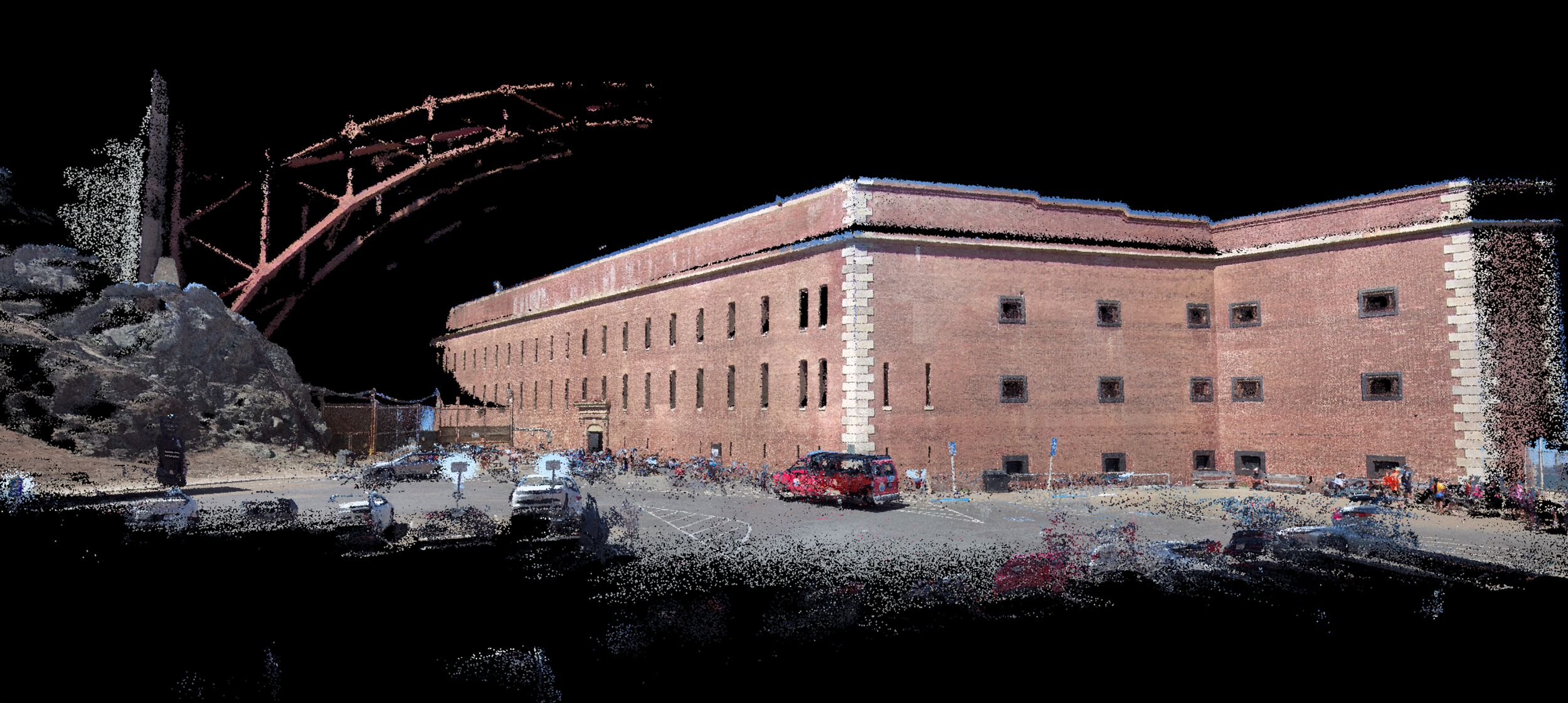
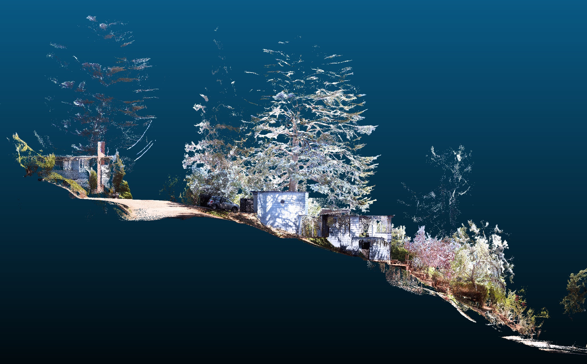
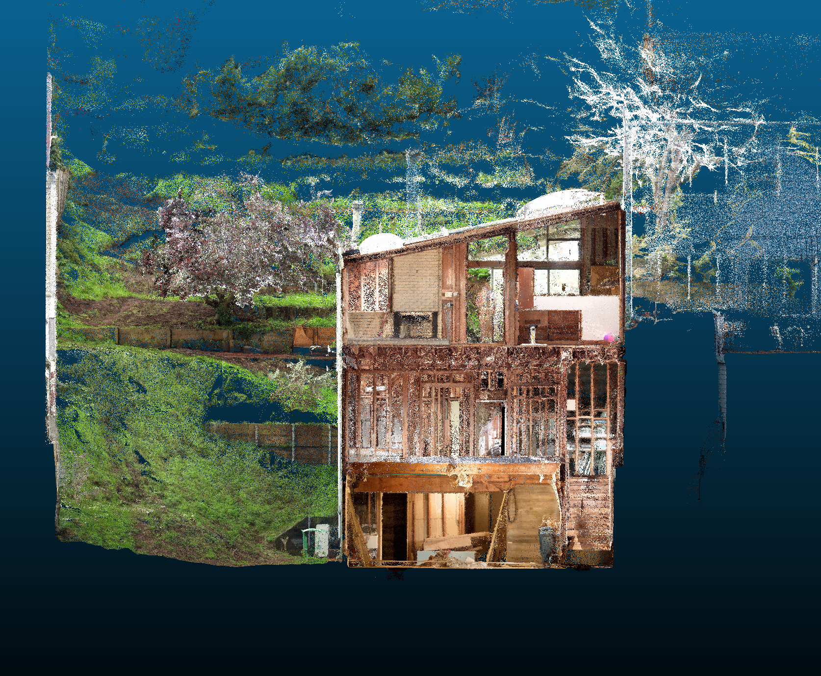
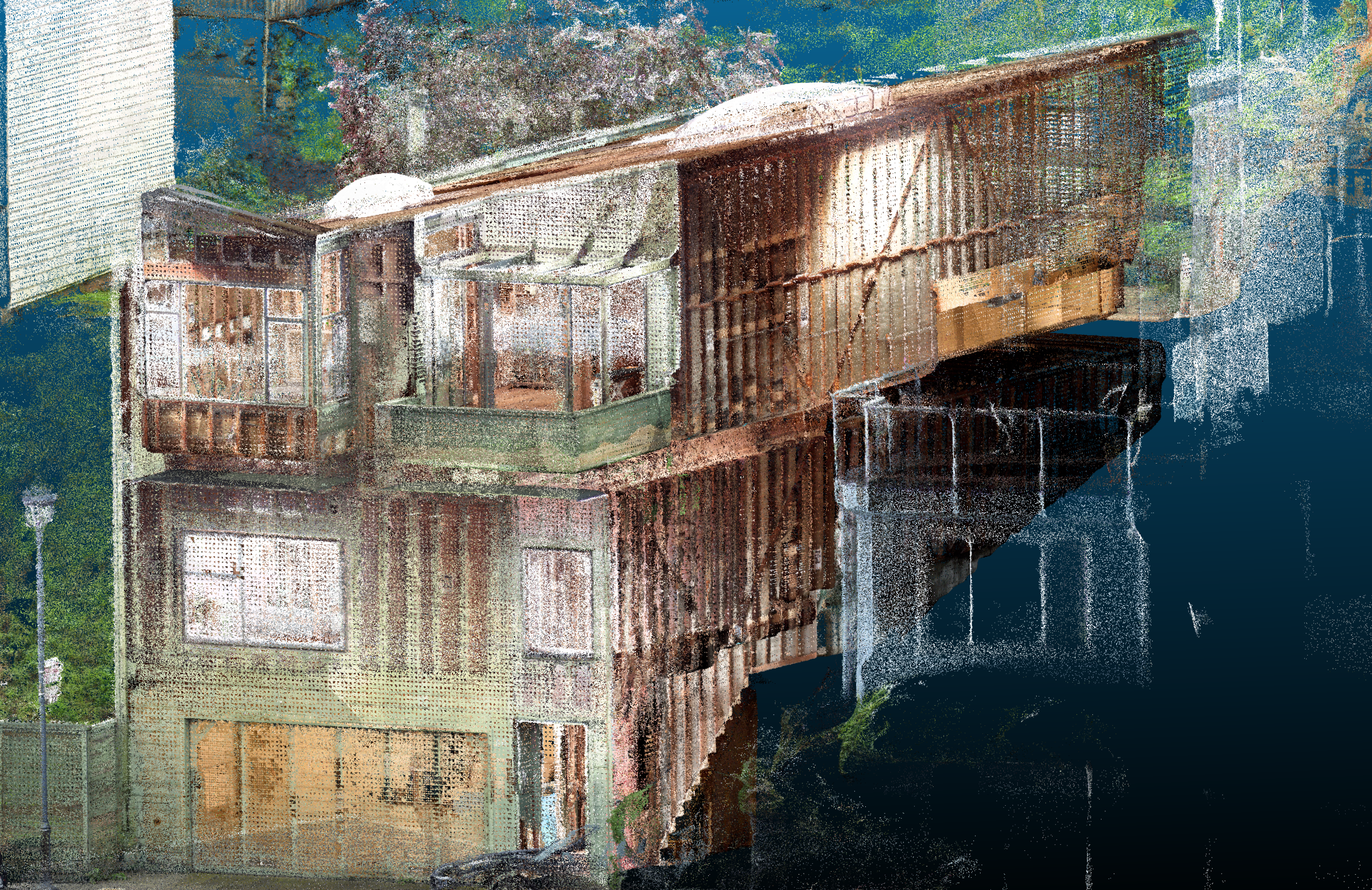
SCAN OF FORT MASON USING SHARE SLAM20 - CONTACT US FOR DATA SET
Our Process
This process transforms physical spaces into precise digital assets through a multi-layered data capture and modeling approach.
1. On-Site Data Capture
The foundation of the process relies on high-fidelity reality capture.
LiDAR Scanning: We begin with SLAM LiDAR scanning to capture the exact geometry of the structure. This creates a dense point cloud, ensuring millimeter-level accuracy for all measurements.
Virtual Tour Creation: Simultaneously, we conduct 360-degree photography to generate an immersive virtual tour. This provides a visual reference that allows stakeholders to "walk through" the site remotely, adding context to the raw data, it also provide us with 2D Floor Plan LiDar Data
Point to Point Measurements: Laser Measurements using Leica’s laser system to fine tune overall measurements.
2. Aerial Drone Survey
To capture the building envelope, roof, and surrounding terrain, we deploy drone technology.
Photogrammetry & Modeling: The drone survey captures high-resolution aerial imagery. This data is processed to create a detailed 3D Model Mesh, filling in gaps that ground-based scanners might miss, such as high roofing or site Elements (Example)
3. Processing & Modeling
Once the data is gathered, our team moves to the processing phase.
2D Documentation: Using the accurate point cloud data, we draft precise DWG 2D Drawings (floor plans, elevations, and sections) that reflect the true as-built conditions.
BIM Development: We construct a semantic BIM (Building Information Modeling) model. This intelligent 3D model integrates the geometry from the LiDAR scan and the context from the drone survey, creating a digital twin of the facility.
Comprehensive Deliverables Package
BIM Model A fully parametric 3D model (e.g., Revit, ArchiCAD) ready for analysis and design.
3D Model A geometry-focused model available in the software format of your choice.
DWG 2D Drawings CAD-ready plans, sections, and elevations for immediate documentation use.
Virtual Tour An interactive web-based walkthrough for remote site visits and collaboration.
Drone Model A textured 3D mesh providing accurate exterior and site context
Why Choose This Process?
Holistic Data: By combining LiDAR (internal/structural) with Drone (external/site), you eliminate blind spots.
Accuracy: Leveraging point clouds allows for the creation of BIM models that closely mirror* physical reality. This high-fidelity approach minimizes onsite discrepancies and streamlines the transition from design to construction.
Versatility: The package supports architects / Designers (BIM/DWG), facility managers / Real Estate Agents (Virtual Tour), and other professionals (Drone Mesh) simultaneously.
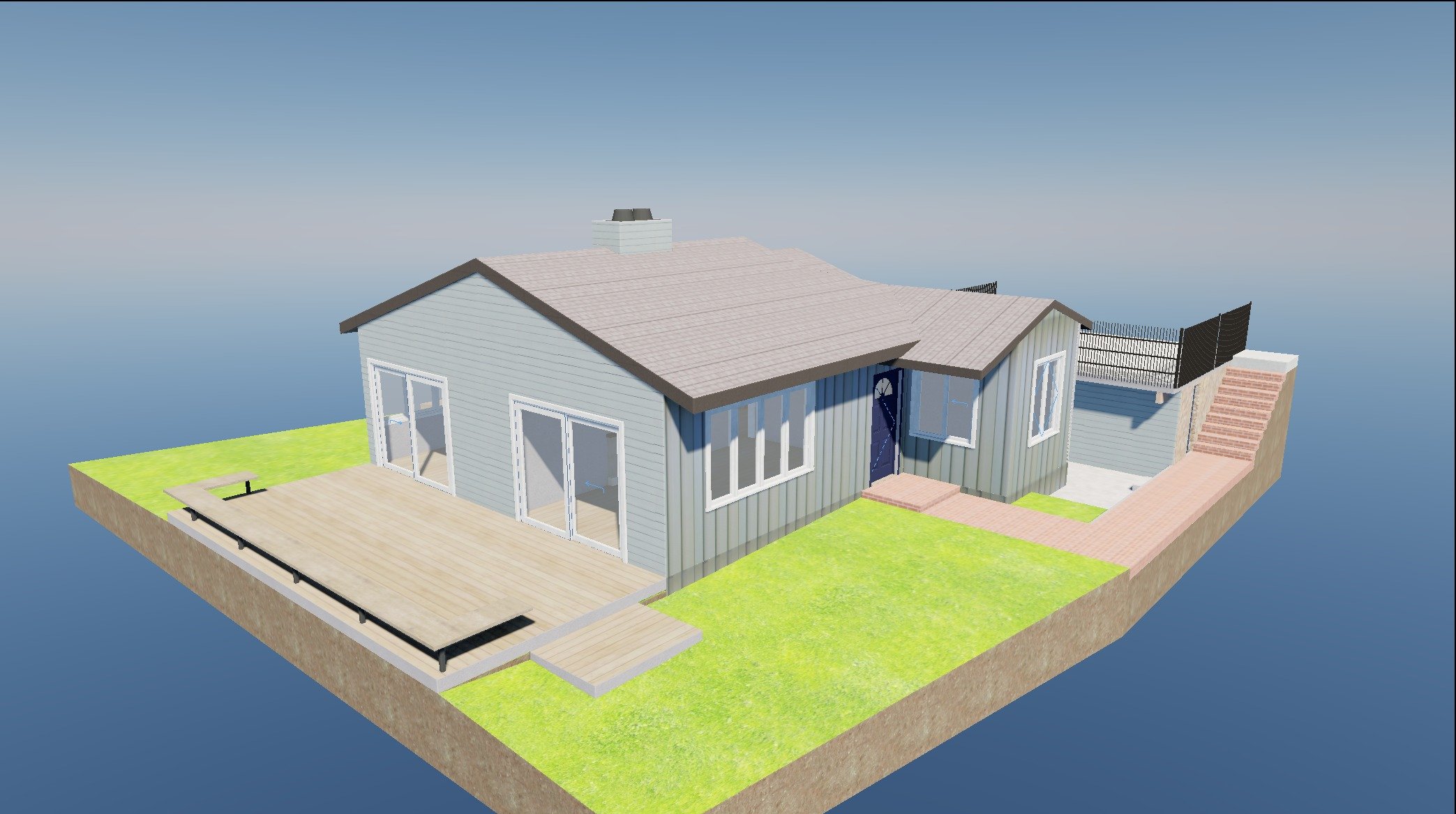
BIM Model
Maximize the profitability of your projects with Plan Reason’s efficient BIM modeling services. By digitizing your build before breaking ground, we identify Current conditions to aide in the design process. Our streamlined models ensure your team moves from design to construction faster, keeping your desired timeline for the project
2D Cad Drawings
At Plan Reasons, the generation of 2D drawings is a precise extraction process From the completed BIM mode. Once the 3D model is rigorously verified against the point cloud data and Point to Point measurements, we generate architectural views by cutting specific horizontal and vertical sections through the digital geometry to create floor plans, elevations, and sections. These views are then cleaned and formatted to ensure industry-standard layering and linework quality. Finally, we export these views as native DWG files to serve as reliable CAD backgrounds for consultants and design teams, alongside high-resolution PDF sets for immediate visualization and printing. This workflow guarantees that all 2D documentation is geometrically identical to the 3D model and the physical reality of the site.
Virtual Tour
At Plan Reasons, our Virtual Tour services utilize iGuide technology to go beyond simple visual walkthroughs, delivering a data-rich experience that combines immersion with precision. By integrating high-resolution 360-degree imagery with built-in LiDAR laser scanning, The result is a comprehensive digital asset that serves as a powerful tool for marketing, facilities management, and architectural planning, significantly reducing the need for return site visits.
Drone 3D Model
At Plan Reason, our Drone Photogrammetry services elevate site documentation by capturing the crucial aerial data that ground-based methods often miss. We utilize advanced UAV technology to survey building envelopes, intricate roof geometries, and surrounding topography with high-resolution precision. This imagery is processed into detailed 3D textured meshes and orthomosaic maps, providing vital context for site analysis, master planning, and condition assessments. 1 By integrating this aerial perspective with our terrestrial scans, we deliver a complete, gap-free digital representation of your project, ensuring that even the most inaccessible areas are accurately modeled and measured
Bay Area | San Francisco Completed Projects
-
![]()
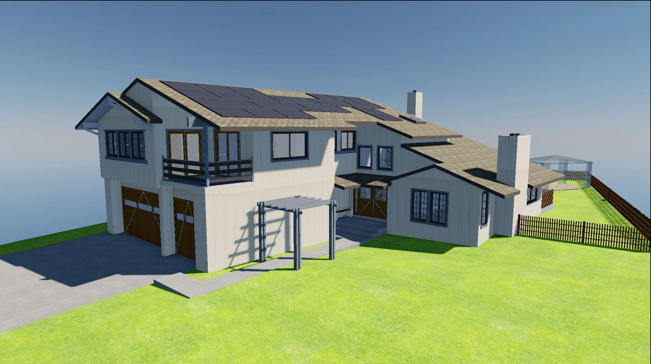
South Bay House
Residential As-Built in South Bay
-
![]()
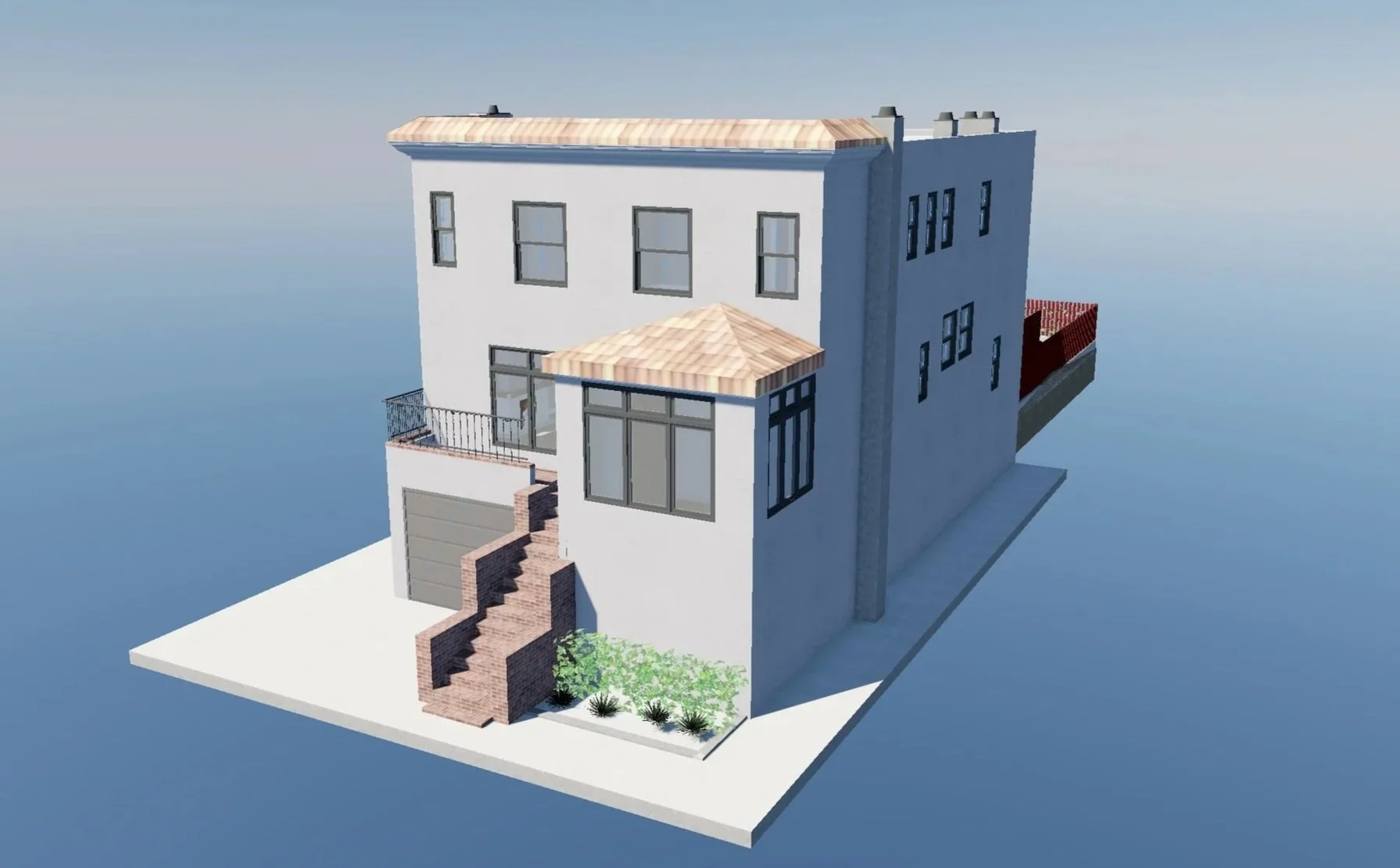
SF House 1
San Francisco Single family home
-
![]()
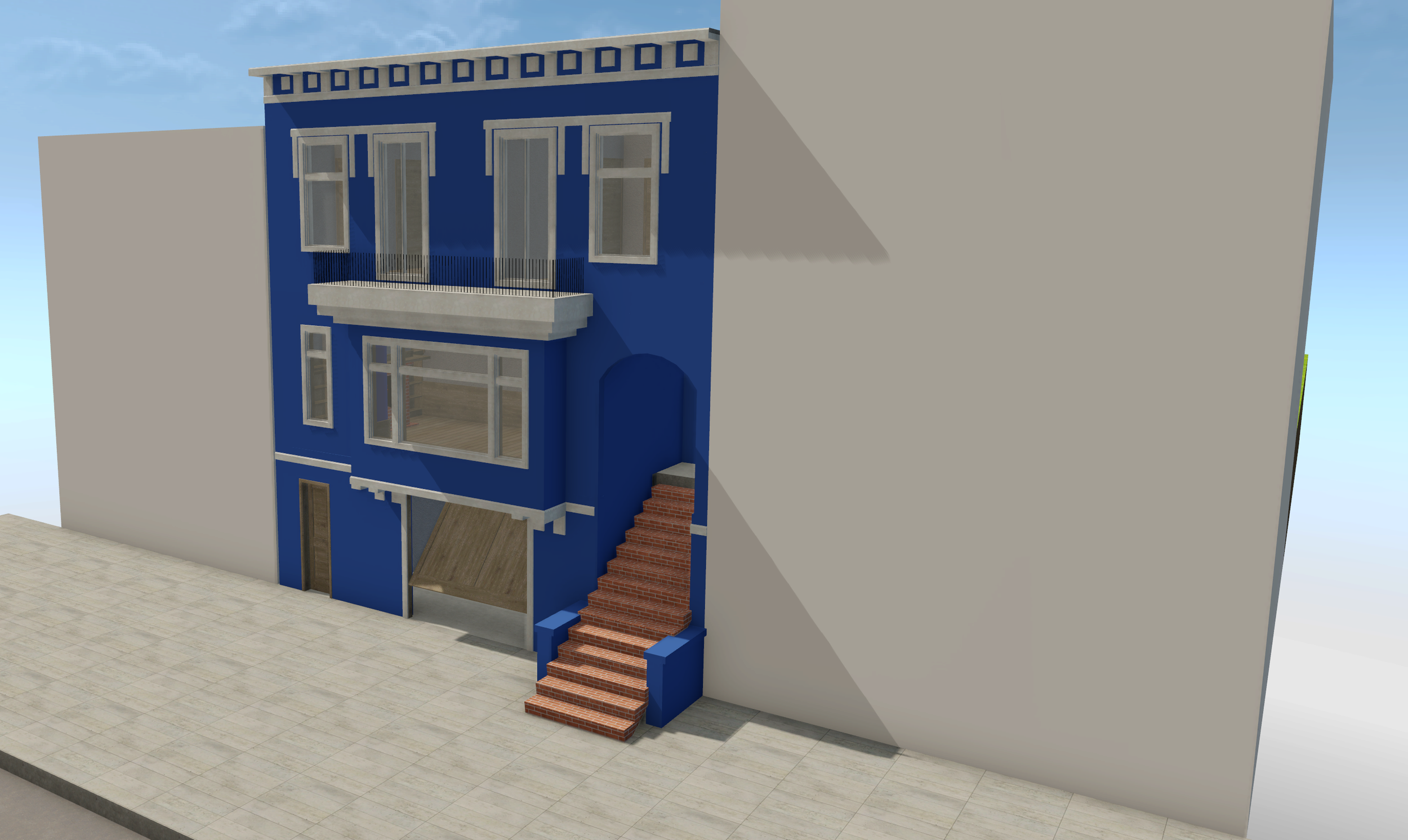
SF House 2
Single Family House in San Francisco
-
![]()
Susalito House
Description goes here
Scanned Data - Using SHARE LiDar Scanners
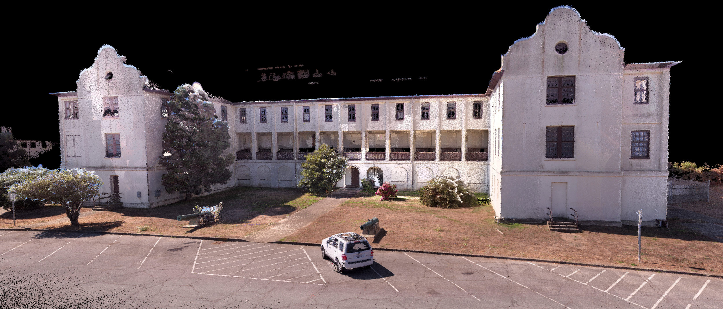
Presidio SF Data Captured Using SHARE S20 | Scan Time - 5 Minutes | Contact us for a complete overview of the Data set (coming soon to the web)
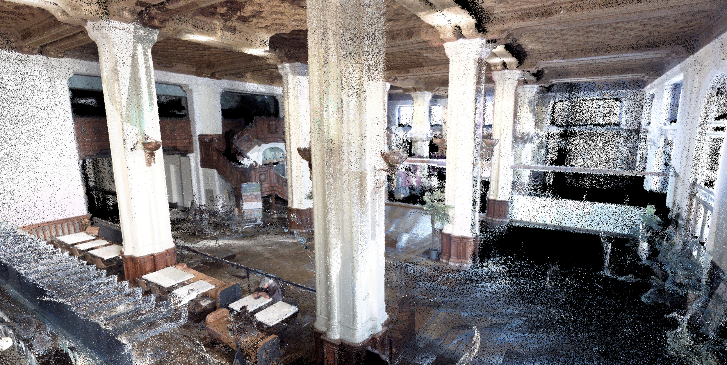
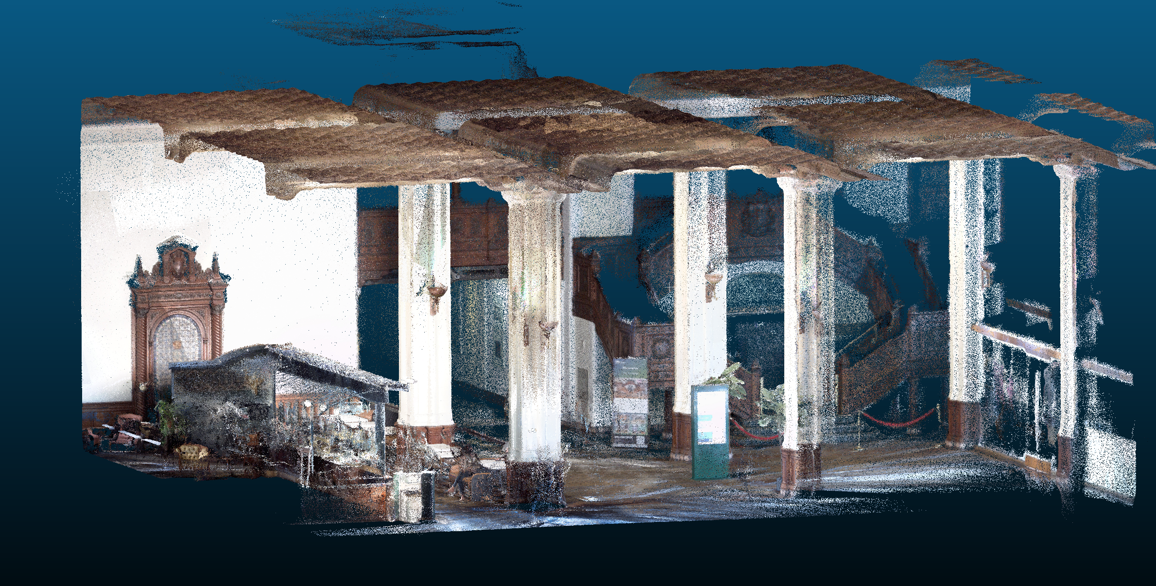
1000 Van Ness Lobby - Data Captured Using SHARE S20 | Scan Time - 9 Minutes | Contact us for a complete overview of the Data set (coming soon to the web)
Oakland House Data Captured Using SHARE S20 | Scan Time - 25 Minutes Including Site and Topo | Please Allow time for Data to load, speed depends on internet connection

SF House Data Captured Using SHARE S20 | Scan Time - 20 Minutes Including Site and Topo